The CRS4 has registered with the SIAE, the Italian Society of Authors and Publishers, 27 unpublished software, thereby obtaining a paternity certification as proof of their existence.
Giacomo Cao, the sole administrator of CRS4, stated: “Thanks to the effort exerted by our technologists and researchers, activities for protecting the Center’s know-how continue, materializing in the registration of 27 software, 22 of which were developed in 2023. In the coming weeks, we will assess whether any of the software deserves patent protection, which can be carried out in both the United States and China.”
The deposited software is applicable to various contexts and specifically enables:
- real-time collection of georeferenced time series data from various sources and types of sensors;
- efficient management of computing clusters through the representation of resource status, occupancy, consumption, and cooling needs, ensuring the efficiency and promptness of potential interventions through an integrated alert system;
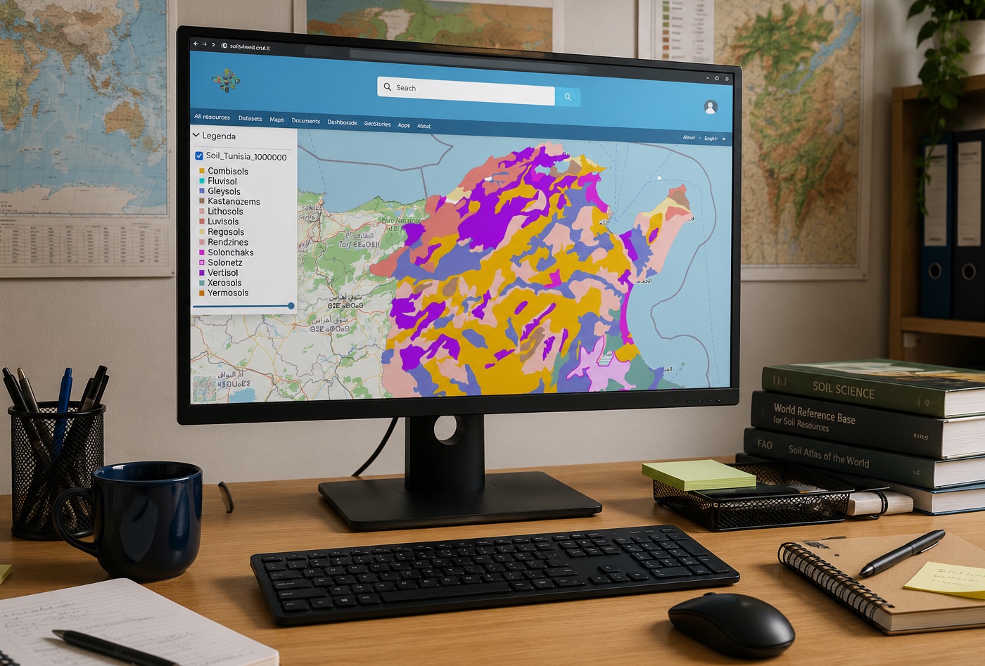
- construction and presentation of geographical maps indicating agriculturally-vocational territories using vector and satellite data;
- health monitoring in forestry and agriculture;
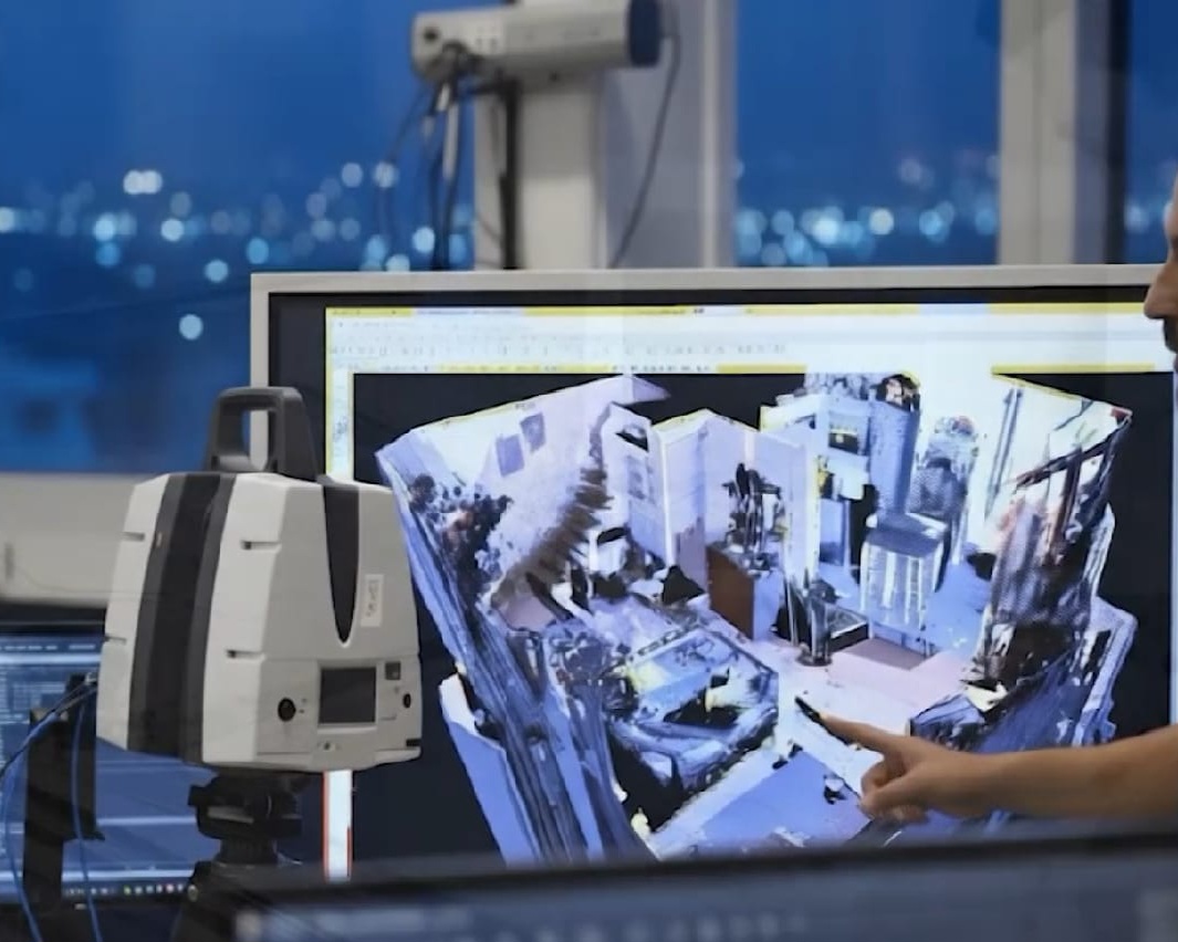
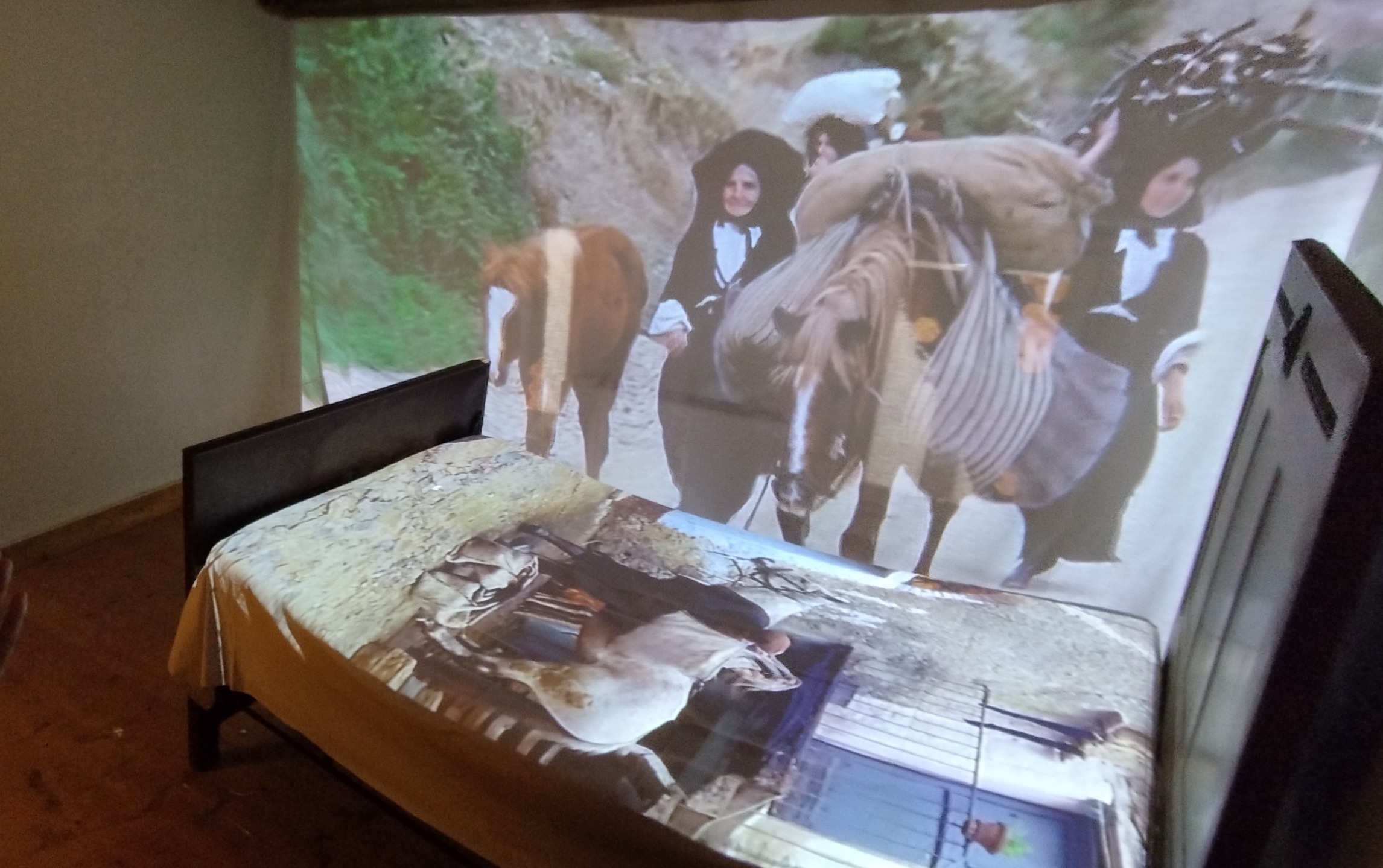
- management of multimedia content (images, videos, environments, and 3D models) and their display on screens in public spaces made interactive through proximity interaction systems;
- selection, through a specific algorithm, of a specific area of interest and available zones suitable for hosting cameras;
- reading of genetic data produced by sequencers and sequence mapping;
- automatic recognition of Italian Sign Language (LIS) through an artificial neural network model;
- intelligent management of energy flows in microgrids;
- acquisition and processing of agrometeorological data (temperature, humidity, rainfall, solar radiation, wind, etc.) for the evaluation of operational risk indices for agriculture;
- visualization of 3D content in various formats;
- exploration of augmented reality brochures through real-time video mapping;
- touch exploration of multimedia content (images, videos, 3D, virtual tours) on a map and through voice search;
- creation of a video archive for LIS (Italian Sign Language) through a personal device equipped with a webcam;
- identification of dynamic gestures in Italian Sign Language and training of a system for recognizing static poses;
- exploration of content through real-time object and hand recognition;
- evaluation of air quality in urban areas elaborated through information on traffic flows, pollutant concentrations, and weather data;
- generation of virtual tours with automatic 360° photo mode;
- customization of interactive panels for the localization of hotspots on a map, associating them with informative cards containing text and images, which can in turn contain launch buttons for external applications;
- simulation of climbing actions;
- analysis of the hourly trend of nitrogen oxides in the metropolitan area of Cagliari;
- creation of a network of heterogeneous nodes that meet security and privacy requirements, where every interacting entity, be it a device, an application, software, or user, is registered and authenticated to enable communication with other nodes in the network;
- automated data archiving through an AI system to allow for quick search and visualization;
- simulation of the capture of carbon dioxide from large sources, such as power plants, and its subsequent storage.